NYC area could get 13-foot waves, coastal flooding due to Hurricane Erin impacts
Aug. 20, 2025, 12:12 p.m.
The National Weather Service issued a coastal flood watch for Thursday night, and a high-surf advisory is in effect until Friday night.
Hurricane Erin is making waves in the New York metro area, even as the megastorm is tracking far offshore.
The National Weather Service has issued a coastal flood warning for the southern shores of Brooklyn, Queens and Long Island from 5 p.m. Thursday until 1 a.m. Friday, and for the entire Jersey Shore through 2 a.m. Saturday. Some areas could see more than 2 feet of flooding.
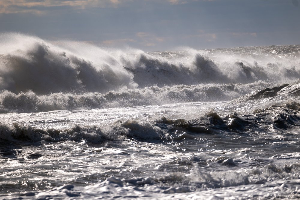
High-surf advisories are also in effect at regional beaches, with meteorologists predicting waves between 4 and 13 feet tall, and potentially up to 16 or 17 feet tall, this week. The biggest effects are expected Thursday night, and officials are urging people to stay out of the water amid life-threatening rip currents.
“There will be a possibility for widespread moderate coastal flooding, especially in vulnerable locations near the waterfront and shoreline,” said John Murray, a meteorologist for the NWS’ New York office. “Given how high the surf is, it’s very dangerous to be out there in the water.
Wednesday 4 PM Update:
— NWS New York NY (@NWSNewYorkNY) August 20, 2025
Coastal Flood Warnings and Advisories are in effect beginning with the Thursday PM high tide cycle. Many places along the coast may have more minor impacts lasting into the 2nd high tide cycle on Friday. pic.twitter.com/nIrJw9r4mc
He added that area beaches could be eroded by the supercharged tides, especially toward the eastern end of Long Island. Strong winds are forecast as well.
⚠️🌊 Hurricane Erin will make its closest pass to our region today. There have been no major changes to the forecast through tonight. Widespread minor to moderate coastal flooding is forecast, along with strong winds and life threatening surf conditions. #NJwx #DEwx pic.twitter.com/73NVYtksVP
— NWS Mount Holly (@NWS_MountHolly) August 21, 2025
Hurricane Erin was classified as a Category 2 storm as of Thursday morning and was predicted to veer northeast over the Atlantic Ocean.
A coastal flood advisory will be in effect for the Long Island coastline from 5 a.m. to 1 p.m. Friday, and again from 6 p.m. to 2 a.m. Saturday.
Hurricane #Erin 5am 8/21 Key Messages: Tropical storm conditions are occurring along the NC outer banks & should spread to the coast of southern #Virginia this morning. Hazardous beach conditions & life-threatening rip currents will continue at U.S. east coast beaches for the… pic.twitter.com/3zjbQQOeTL
— National Hurricane Center (@NHC_Atlantic) August 21, 2025
Separately, showers passed through the area Wednesday, bringing locally heavy rain and chances of minor flooding through Thursday morning.
This story has been updated with additional details.
Beaches close across NYC and NJ as Hurricane Erin brings dangerous swells to region