Forecast: Cloudy With A Chance Of Tornado
May 28, 2019, 4:30 p.m.
Goodbye, sun.
Remember when it was nice out for one
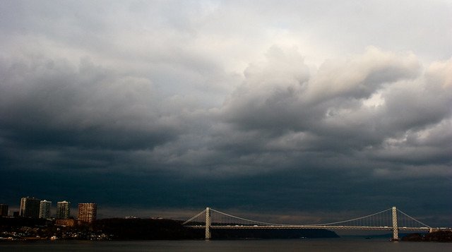
I hope you made some fond fairweather memories this weekend, because that's the last you'll be seeing of the sun for some time. This week, according to my phone's weather widget but also the more reputable National Weather Service, presents rain and wind and even the possibility of a rogue tornado.
Yesterday's glorious and summery temps faded into the high-60s arena today, but the alleged 69-degree high feels, in my recent experience, a hell of a lot more shivery than that. We have mostly unbroken cloud cover and rain to thank for the meteorological bamboozle, and can expect this current "chance of rain" to hold throughout the evening. Around 8 p.m., those odds escalate to a likelihood, with a side of thunderbolts possible.
The downpour may ease up around 11 p.m., but you clicked this forecast because of a banner piece of news baked into the headline: Urban cyclones. Well, here comes the twister (per the NWS, with heavy emphasis on the word "possible"):
There is a chance of strong to severe thunderstorms developing late this afternoon into this evening along a warm front. The main threat will be damaging winds and large hail, however, an isolated tornado is possible. The threat is highest just west of the NYC metro.
So you're probably fine! Probably. Unless you get clobbered by some hefty, sideways-blowing ice balls. I recommend you shelter in place until tomorrow, if at all possible, because Wednesday's conditions look mostly dry and pleasantly warm (low 70s, hell yes) until about 4 p.m. At that point, we may again face a chance of showers, with low potential for accompanying thunder-clatter. That backslide should carry us into a disappointingly wet Thursday, with rain especially likely between 8 p.m. and 2 a.m. The afternoon could bring a doozy of a storm, think hail and wind—the whole bit—but at least it will be warm outside? Temps should remain in the high 70s to low 80s for the rest of the week, bottoming out in the 60s.
Right now, I don't even want to talk to you about the weekend, although I can tell you that Friday currently looks dry and warm, the projected temps nearing 80. Past that, it really seems too soon to tell, and so I choose to believe that the frankly uninspiring forecast my phone has assigned to Saturday and Sunday—prime beach real estate—will never materialize. Right now, Saturday looks like the better day, both warmer (possible high of 79) and clearer than Sunday, which may bring clouds and another storm.
So there it is: Maybe a tornado tonight, seemingly definite hail off and on forever (?), and a whole lot of brooding weepy weather. Stevie, take the outro: