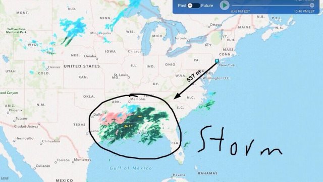
Everything You Need To Know About The Next Nor'easter Summed Up In One Map
Feb. 12, 2014, 12:12 p.m.
Behind the storm, Friday will start out warm and sunny with a high near 40, but there's a chance of romantic rain or snow showers on Friday evening.

Forget all those other, lesser, forecast maps. Last night NY1 tweeted the best forecast map ever. Seriously, what else do you need to know other than a messy storm is headed our way? A few snow fetishists are getting their tighty-whities in a twist about the details—and we'll get to those details—but for the rest of us the important thing to know is that a winter storm warning is in effect starting at midnight tonight. Snow is expected after midnight tonight, and that snow will change over to an ugly rain/sleet/snow mix for a few hours around mid-day tomorrow before changing back to snow tomorrow evening.
On to the details. This storm is a classic nor'easter in that a low pressure system will move across the southeastern states to the area over the warm waters of the Gulf Stream today. Those warm waters will feed the storm, allowing it to strengthen as it moves up the coast tonight. Heavy snow should arrive well after midnight and last through the morning commute.
That's the easy part of the forecast! As the storm moves northward warmer air is expected to reach the city and points eastward. If that happens the snow will mix with rain or sleet for several hours, giving us another several inches of gloppy goo. Northern New Jersey, the lower Hudson Valley and western Connecticut are expected to remain cold enough that only snow falls. The immediate suburbs can expect 6-12 inches of snow, with a foot or more possible not all that far away.
Big caveat: As is often the case with nor'easters there is a very narrow boundary between snow and rain in this storm and the city straddles that boundary. If the storm path turns out to be a few miles west of what's currently expected the balance of precipitation will tip toward rain. Higher snow amounts will occur if the storm takes a more easterly track than what is forecast.
The coastal storm should be over Cape Cod by evening but we then have an upper level low arriving from the Midwest. That second storm (which, since we're going to be hit by two storms, not one, is a very good reason not to give winter storms stupid names) will bring a reinforcing shot of cold air and blustery winds. The precipitation over the city will change back to snow, with another several inches expected before midnight. Behind the storm, Friday will start out warm and sunny with a high near 40, but there's a chance of romantic rain or snow showers on Friday evening.